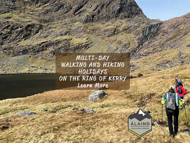


Make a date with Mullaghanattin in the Sneem Dunkerron Mountains on the Ring of Kerry.
Next Guided Mullaghanattin Walk.
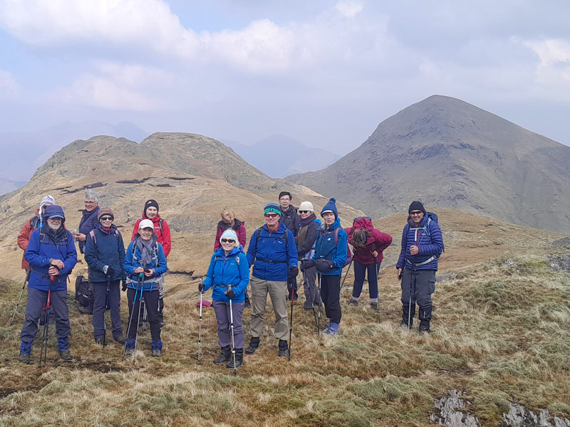
If you’re looking for a breathtaking mountain walk, then look no further than Mullaghanattin in Sneem in County Kerry. Mullaghanattin is the tallest mountain in the Sneem Dunkerron range, which at 773m stands proud above the Ballaghbeama Gap, the glacial breach that divides the Dunkerron range. Due to its prominent shape, some call Mullaghanattin Ireland’s Matterhorn or more precisely Kerry’s Matterhorn.
Photos Don’t Do Justice to this Amazing Kerry Mountain Walk
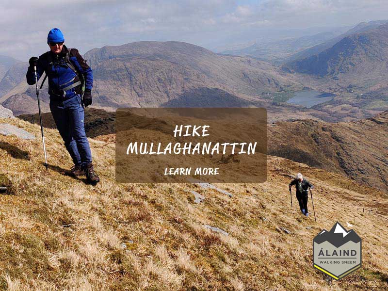
Although considerably less known, Mullaghanattin is one of those places that photographs don’t do justice. To experience its wonderful form and the surrounding Kerry mountains, you simply have to walk there. Trust me it will not disappoint! You can choose the same route to climb up and down or you can complete the longer Mullaghanattin Horseshoe.
Wild and Remote – Yet Close to Sneem Village
When travelling to Ballaghbeama and Mullaghanattin you’re entering a wild and remote part of Ireland with scarcely a house to be seen. Driving the narrow roads requires caution and a bit of nerve too as these roads have many twists and turns.
This is a quiet place and very quickly you’ll find yourself totally immersed in the nature of your surroundings. In doing this walk you’ll spend the next few hours enjoying feelings of peace and the sense of freedom as you pass high above the valleys below.
On the other side of the Mullaghanattin Horseshoe, conveniently lies the hinterland of the village of Sneem – one of Ireland’s favourite and prettiest villages. So you are in fact not as remote as you may first think, which means you can finish your day with refreshments in Sneem and if you have time, a gorgeous meal. If you want a luxury ensuite room for the night, I think you’ll find my bed and breakfast at Álaind Lodges the perfect choice.
The Pretty Village of Sneem – At the heart of the Ring of Kerry
Sneem is a popular village and a food and retail hub on the world-renowned Ring of Kerry route, which sees a great number of visitors passing through each day. Most visitors are spending the day driving the Ring of Kerry and exploring The Wild Atlantic Way.
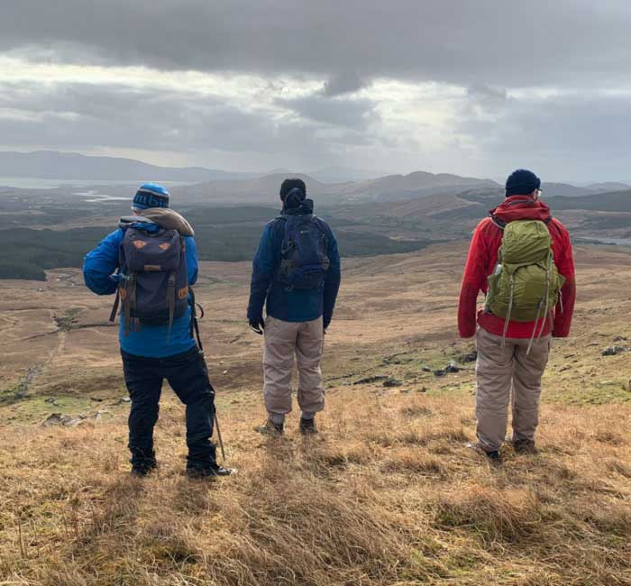
What you might not expect is that the numbers out walking and hiking in this area are relatively few. You may meet a few walkers on the Kerry Way or on one of Sneem’s loop walks, but that’s usually it. The amazing Dunkerron mountains, including Mullagahnattin, will in all probability be still and quiet, which makes for a real adventure.
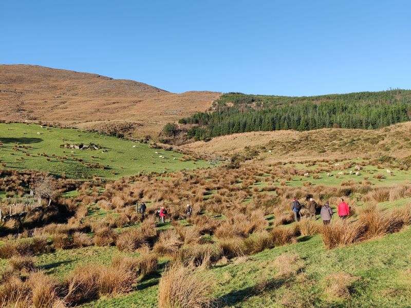
Great Loop Walks very close to Sneem
On the subject of Sneem’s Loop walking trails, namely The Fermoyle Loop and The Lománagh Loop, both are lovely walks and perfect for a group holiday activity. The Lománagh Loop will take approximately 2.5 – 3 hrs and the Fermoyle Loop 4 – 4.5hrs.
Although enjoyable experiences in their own right, they offer fantastic views of the taller Dunkerron Mountains. From either walk, if you look to the North East of Sneem, you’ll see Beann with Mullaghanattin lying just behind.
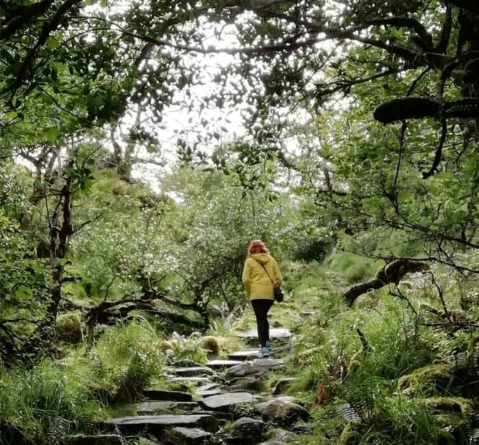
In and around the village itself you will find the Sneem Sculpture Trail, The Riverside Walk and a walk from Sneem Pier through the grounds of Sneem Hotel, all of which can be easily enjoyed if you have a couple of hours.
Sneem’s Wild and Rugged Dunkerron Mountains
The Dunkerrons stretch from Waterville and Caherdaniel all the way to the upper lakes of Killarney. These mountains in Sneem are wild and rugged and they form the impressive and exquisite backdrop to the village. They are a remote place, a world away from its busier neighbours i.e. The Macgillycuddy Reeks (The Reeks). On a clear day you can also see The Reeks to the east in the distance.
Unlike the Reeks, you can scale the Sneem Dunkerrons’ heights and not meet another soul throughout the whole day. If you compare climbing Carrauntoohil to climbing Mullaghanattin, this will be the key difference in my view. Mullaghanattin and the Dunkerrons, in my view give a heightened sense of discovery. With nobody else around, it’s feels like you’re discovering these places for the very first time, thus intensifying the experience.
As well as savouring the panoramic views and natural beauty of this place, no doubt you’ll be feeling proud too. Why wouldn’t you, for walking to the top of a Dunkerron summit is a pretty big achievement. After all, Mullaghanattin is 25th highest of Ireland’s mountain peaks, so you’ll have earned it.
The Sneem Dunkerrons are beautiful and rocky with many hidden lakes and steep mountain walls. If you have the ordnance survey map 84, just take a look at the prevailing contour lines of these mountains. Here you’ll find very few smooth oval shaped contour lines. Instead you’ll find jagged, compact contour lines. These lines denote uneven, rocky and steep terrain – all typical characteristics of the Dunkerrons. That’s why navigating skills and the ability to use a map and compass and/or GPS are important.
Sneem’s Kerry Geopark – A Recognised Area of Significance
The Sneem Dunkerrons are truly a geological wonder and a huge part of what makes the Kerry Geopark special. Kerry Geopark stretches from Kenmare Bay into the mountains and encompasses the villages of Sneem, Castle cove, Caherdaniel and Blackwater. The Geopark status recognises and promotes the unique way of life, traditions, culture and landscape of the area. In fact Kerry Geopark is an internationally recognised area of great geological significance and is an amazing place to walk, explore and enjoy.
Mullaghanattin is a Favourite Horseshoe Full Day Hike
With the location and attraction of the Sneem Dunkerrons now hopefully in context, let me return to Mullaghanattin. Without a doubt, Mullaghanattin horseshoe is one of my favourite all-day walks. Not only do you touch Mullaghanattin’s summit but you’ll also conquer Mullaghanattin East Top, Beann West Top, Beann and Beann South Top too.
Mullaghanattin and Beann at 773m and 752m respectively are two of the tallest mountains in the Dunkerrons. Furthermore, they are the 25th and 34th highest mountains in Ireland and have views to match the best in Ireland.
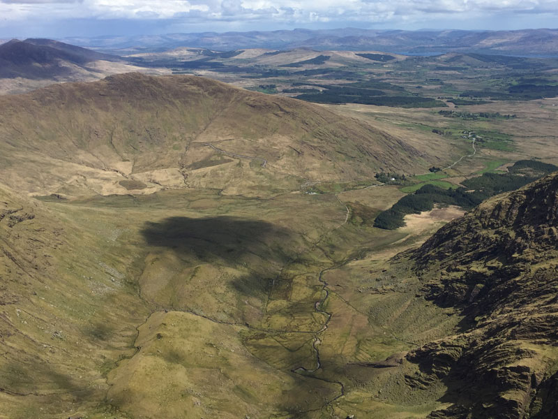
These mountains rise 650m above the coom below and you’ll feel as if you are standing on top of the world. The word Coom to describes a mountain valley surrounded on three sides by the steep slopes. Here, two long spurs flank the coom below forming a perfect horseshoe walk. We call this valley Coom, ‘The pocket’ and indeed it’s a deep one too. and the views looking down from above are inspiring and world class.
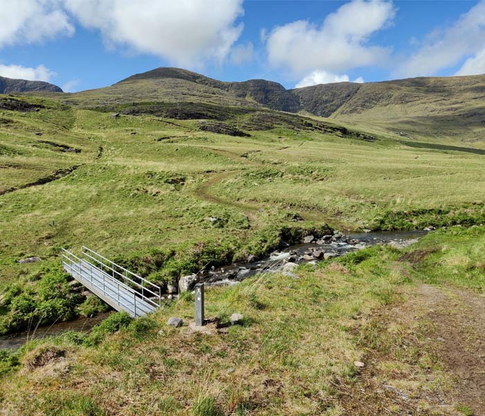
From Ballaghbeama Gap to Mullaghanattin
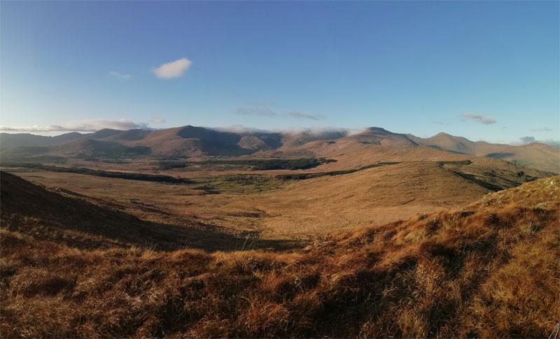
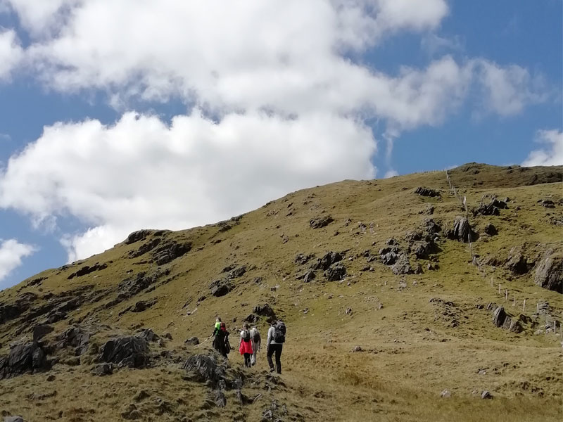
We begin our walk in area of Ballaghbeama, starting out just before reaching the narrow gap itself. Our aim is to ascend to the Eastern spur just off the Mullaghanattin horseshoe itself. Slowly and steadily we start our 300m ascent on grassy slopes onto the spur. Stopping frequently allows us enjoy views of Lough Brinn, the eastern Dunkerron Mountains and the Macgillicuddy Reeks beyond.
Upon reaching the top of the spur (shoulder) at a height of 462m, the ground levels out. From here we continue our walk westwards for one-and-a-half km, crossing Mullaghanattin East-top and some map spot heights along the way. Ahead of us now we see the steep climb of Mullaghanattin (773m).
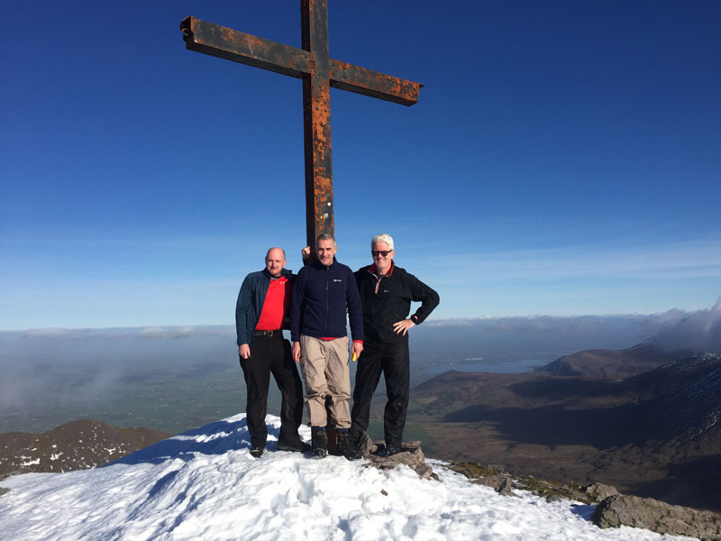
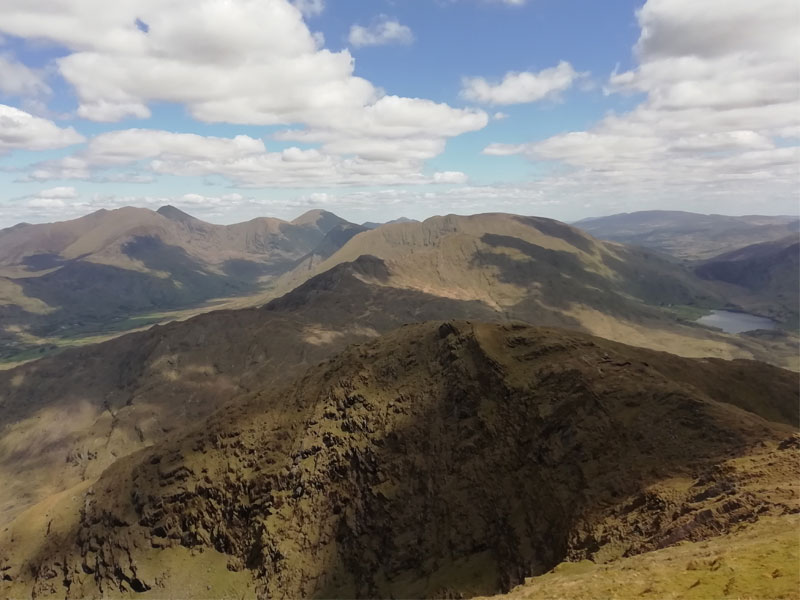
Reaching the top involves a slow, steep climb but the grassy ascent makes it feel friendly. I’ve stopped here on a number of occasion for a break and a snack, particularly lovely when the sun is shining. Before long we reach the top and it does not disappoint. The summit views across the entire Ring of Kerry’s Iveragh peninsula are superb. Very rewarding indeed!
Often Called The Kerry Matterhorn
As I mentioned some call Mullaghanattin the Kerry Matterhorn or Ireland’s Matterhorn due to its profile. It’s also distinctive as a trig point station marks its summit. In earlier times, prior to aerial photography and GPS, mappers used these trig points for triangulation and positioning.
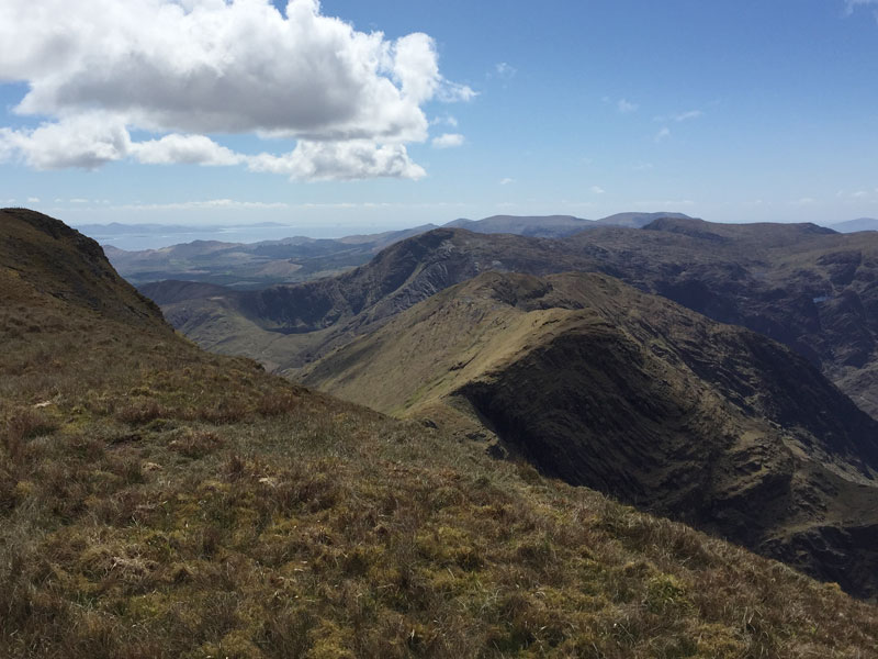
The 360-degree view from Mullaghanattin across the Dunkerrons, The Reeks, Kenmare Bay and the Beara Peninsula is simply stunning. I hope when you get there the weather is equally kind and the skies clear.
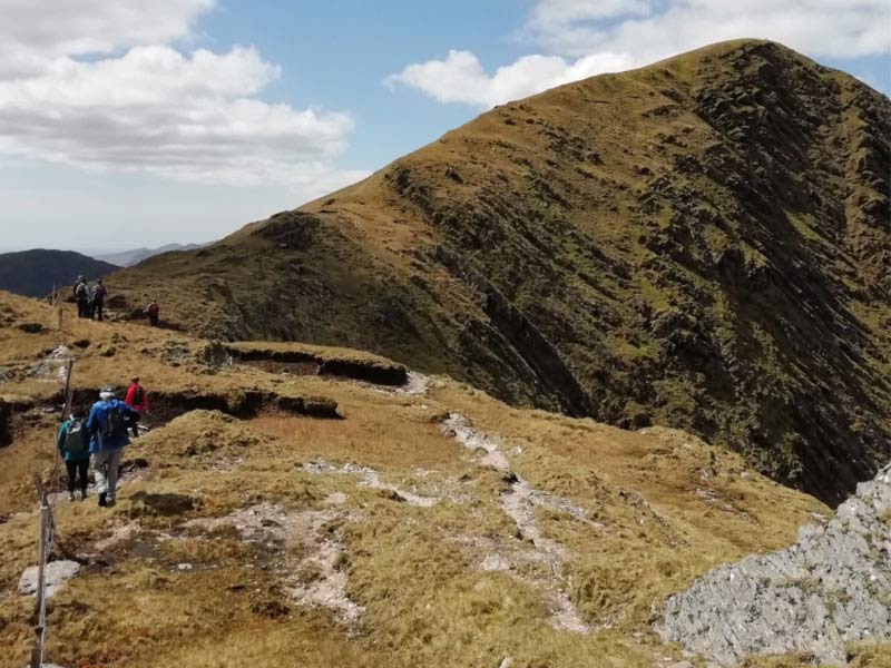
Descending the far side of Mullaghanattin is relatively easy but take care to avoid a number of small rocky outcrops. Ahead lies Beann North East Top which is our next target at a height of 692m. You can contour around this instead to proceed directly to the grassy Beann ridge.
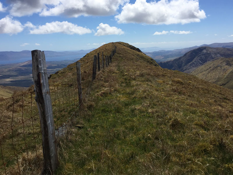
The Beann Ridge is Exhilarating
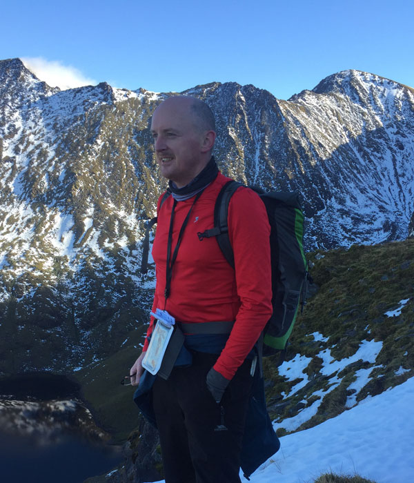
Beann’s grassy ridge walk with its precipitous falls on either side is an exhilerating treat. I say this because thankfully there’s sufficient walking room on either side of the fence running along its length. Still, it does require somewhat of a head and stomach for Heights!
The first time I reached this ridge was on a calm sunny day. I remember how surreal it felt standing atop a 750m exposed ridge, without the slightest breath of wind. It was so unexpectedly still and quiet that the sound of the silence was very real and surprised me greatly. This section of the grassy ridge is 360m long, which makes for quit a unique walking experience.
As we reach the ridge’s end, we now can safely view ‘The Pocket’ below in all its glory. Its steep walls rise 650m up to meet us, giving us a wonderful view of the horseshow.
Coomyanna Valley – A hidden treasure
Looking southwest now, we see Sneem Village in the distance and the Sneem River estuary flowing out into Kenmare Bay. Below is the idyllic valley of Coomyanna and its two lakes of Coomeen & Sallagh. The sun is shining on this spot, so we sit on the edge of the ridge and break for lunch.
In days gone by a visit to Coomyanna by horse and cart was something akin to a trip today through Killarney National Park or The Gap of Dunloe. Coomyanna was a popular tourist excursion as detailed in the book Sneem – The Knot in the Ring by T.E. Stoakley. He writes (where ‘car’ means any horsedrawn conveyance) that at the beginning of the 1900s you could take the following recommended excursion from Parknasilla:
“Car to Sneem and Coomyanna Bridge, pony (5 shillings to top and back not included) or walk to the summit of Beoun Mountain”.
The cost for this excursion was 12 shillings and even though the crowds and ponies are a thing of the past, I doubt Coomyanna’s beauty has lessened any!
The mountain walk descends gradually southwards from Beann to a track leading into the valley farms near Coomyanna Bridge. This bridge marks the start of a minor road into Sneem and our transport pickup point back to Álaind Lodges.
In reaching Coomyanna Bridge we have walked 10 KM and climbed 850m upwards. I think you’ll agree that this walk is a delight rather than an endurance test. Of course if you prefer longer walks, you can walk to Sneem adding an additional 8 KM to the total.
Alternatively, you can lengthen the Mullaghanattin Horseshow by starting and finishing on the road leading into the Pocket itself. You can choose to complete the walk in clockwise or anti-clockwise, perhaps depending on the day’s weather. Lengthening the walk in this way adds Cnoc Riabhach and the full length of Faha Mountain i.e. and extra 4 KM to the total. Enjoy!
If you want to make a date for a Mullaghanattin walk, you can contact Fergal Harrington directly by email or by phone or WhatsApp at +353-85-1422677.