

Next Guided Carrantoohil Hike.
If you’ve a passion for walking and hiking challenges, go ahead and add climbing Carrauntoohil, Ireland’s highest mountain to your list. In fact, while you’re at it, put it at the top of your list. With good planning and preparation most walkers will successfully climb to its summit.
In this post I’ll share general details for context such as the mountains location, height, time to summit and road access. These will whet your appetite and help you decide if you want to accept the Carrauntoohil challenge. Hopefully you might then join us on a guided hike to the top or make a short break holiday of it.
Thereafter, I’ll go more into the details of what to expect hiking Carrauntoohil; climbing routes options; weather conditions; recommended gear; and the guided tours we offer.
So without further ado, let’s answer some common questions about this most wonderful of the Kerry Mountains.
Where do you go when hiking Carrauntoohil?
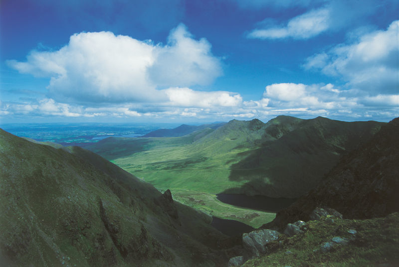
Carrauntoohil is the central peak of the Macgillycuddy Reeks, a mountain range circa 20km or 25 min drive from Killarney in Co.Kerry, in the south west of Ireland.
You will locate it at the following coordinates:
- Latitude 51.99943 Longitude -9.74271
- OSI Map 73 Grid Reference V80352 84427.
If you intend traveling by car you can use any of the three official car parking areas, namely Cronin’s Yard, Lisleibane or Hydro Road. Here’s how to get to each of them from Killarney.
Killarney to Cronin’s Yard
Take the N72 Killorglin Road. After Fossa Village, take the left turn in the direction of the Gap of Dunloe. Continue on this road for circa 8km until you come to a signpost for Cronin’s Yard &Tea Room and Carrauntoohil. Then, take the left turn and follow for 3km to reach Cronin’s Yard.
You will locate Cronin’s Yard at the following coordinates:
- Latitude 51.99943 Longitude -9.74271
- OSI Map 73 Grid Reference V80352 84427.
Lisleibane Parking – https://bit.ly/hydro-road From Killarney: Follow same route as above for Cronin’s Yard but for Lisleibane continue 1.5km beyond the Cronin’s Yard turning before turning left. Continue for 3.3km on thi road to reach Lisleibane car parking.
Killarney to Lisleibane
From Killarney: Follow same route as above for Cronin’s Yard but for Lisleibane continue 1.5km beyond the Cronin’s Yard turning before turning left. Continue for 3.3km on thi road to reach Lisleibane car parking.
You will locate Cronin’s Yard at the following coordinates:
- Sat Nav Coordinates: Lat: 52.02598 / Long: -9.70983
- Grid reference OSI Map 73: V 82677 87300
Killarney to Hydro Road
You will locate the Hydro Road at the following coordinates:
- Sat Nav Coordinates: Lat: 52.02280 / Long: -9.79071
- Grid reference OSI Map 73: V 77144 87071
How Tall is Carrauntoohil?
Carrauntoohil is 1039m tall which makes it the highest mountain in Kerry and in Ireland. It lies 3km west of Cnoc ne Peiste 988m which is Ireland’s second tallest mountain and also in the MacGillycuddy’s Reeks.
Carrauntoohil is part of the Coomloughra Horseshoe, the well know walking loop hike which includes the peaks of Caher 1,001m and Beenkeragh 1010m. However because ridges connect Carrauntoohil to Caher and Beenkeragh (and neither has sufficient prominence) neither are included on the list of Ireland’s tallest mountains. Of course this does not detract from the thrill of clambering across both of them when completing the Horseshoe. Take care when crossing its exposed ridges which should only be in attempted in fine weather conditions.
How long does hiking Carrauntoohil take?
Carrauntoohil takes from 4 – 6 hours to climb via the most direct route known as the Devil’s Ladder. Depending on the route you choose your take the time may differ considerably.
However you can work out an approximate time as follow:
- The walk from Cronin’s Yard to the foot of the Devil’s Ladder is approx. 4.5km. At 4km / hour this will take approximately 70mins.
- To cover the 500m ground distance to the top of the devils ladder at 4km / hour will take approx. 10min. Add to this the time approximately 30 mins to climb the 250m elevation to the top of the ladder. Section time 40mins.
- From the top of the Ladder to the summit of Carrauntoohil is approximately 1km – 15min. To account for the remaining 300m elevation climb to the top will take 30 mins. Section time 40mins.
Therefore, you can expect the hike to the top of Carrauntoohil to take approximately 2.5 hours and a similar amount of time to return. When you add in some rests, snack breaks and taking in the sights, your return trip might be closer to 6 hours. Obviously these are rough estimates and the time it takes you will depend on fitness, experience, weather conditions, the number and duration of breaks and other factors.
How the Carrauntoohil Weather can affect Hiking.
Studying the weather forecasts in the days and hours before your planned Carrauntoohil hike is essential for your safety. The weather in the Kerry Mountains can exhibit extreme conditions and consequently there are some days when you should avoid hiking Carrauntoohil altogether.
You should at least consider the following factors when reviewing the Carrauntoohil weather forecast:
Expect lower temperatures when climbing.
You should expect temperatures on the mountain to be considerably colder than on its approaches. Temperatures can drop by between 0.5 and 1 degree Celsius for every 100m increase in elevation.
Beware hiking in Strong Winds and gusty conditions.
It is reasonable to expect winds to be two to three times stronger on the summit than at sea level. Furthermore wind can accelerate unexpectedly at pinch points on the mountain and you should take great care on steep or precipitous slopes.
Rain makes climbing uncomfortable and slippy.
It is essential that you remain dry while climbing Carrauntoohil and wear suitable waterproof layers and footwear. When walking in the Magillycuddy Reeks, it is typical to set out in dry conditions but to turn wet once you reach the low cloud level. Wet trails also make conditions underfoot precarious and requires great care to be taken.
Know Your Limits when hiking.
The combination of cold temperatures, wind, wet, tiredness and unpredictable conditions has led to many mountain rescue situations. Know your limits and when in doubt about the suitability of the conditions, choose another day. As well as potentially having a miserable experience due to inclement weather in the Kerry Mountains, hypothermia onset is a potential real risk. Visibility – It’s quite common to experience poor visibility and white out conditions at reasonably low heights. In all likelihood some or all of your Carrauntoohil hike could include poor visibility and therefore you should have good navigational skills within your walking group. If you aren’t confident using a map and compass or a GPS device, you would be wise to hire a guide or travel as part of an organised Carrauntoohil fully guided hiking tour.
Climbing Carrauntoohil – why do it?
Carrauntoohil and the Macgillycuddy Reeks range on the Iveragh Peninsula on the ring of Kerry are the most majestic and tallest of Ireland’s mountains. Standing between Killarney, Glencar and Sneem they also offer arguably the best hiking and walking opportunities in Ireland.
You could easily spend a week hiking in this area while doing a different walk every day. Irrespective of which route you choose, each challenge gives you a fantastic sense of achievement. As the adage goes ‘the best view comes after the hardest climb’. Similarly from my own experience, the best sandwich and cup of tea are those consumed on reaching the mountain summit.
Carrauntoohil Hiking Routes
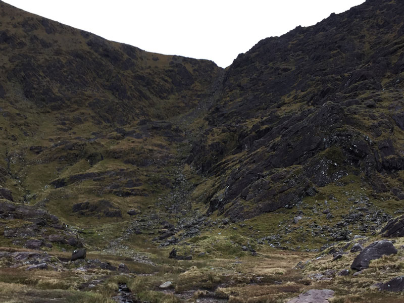
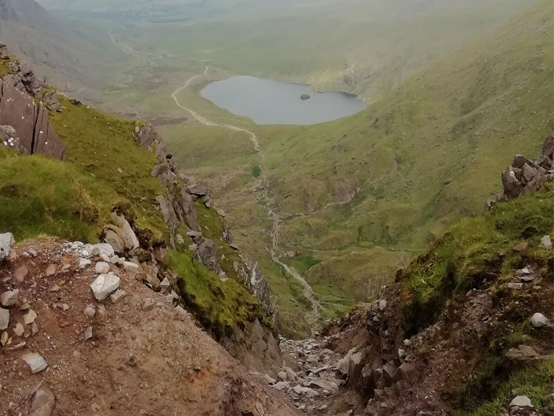
Devils Ladder is The Most Popular Route.
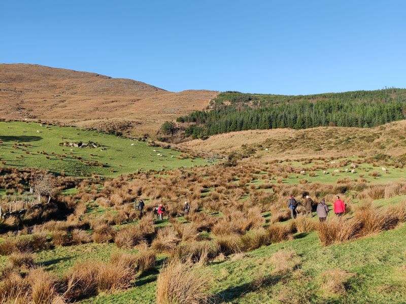
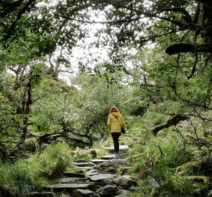
The most climbed route to the top of Carrauntoohil is via the steep gulley known as The Devil’s ladder. Most people climbing this route start at Cronins Yard. As you might expect Carrauntoohil can get busy during summer months due to its popularity its proximity to the Killarney tourist town. The devil’s ladder is a direct but narrow eroded track where you might have to step aside and let oncoming Walkers pass. As we saw above, this route will probably take 5 plus hours to reach the summit and back.
The good news is you can reach top of Carrauntoohil from a number of other quieter walking routes that are further from Killarney. Some of these start from the western and southern approaches, which you easily reach from Sneem village. Sneem is Álaind Walking’s home, making it a convenient base exploring this and other spectacular Kerry mountains in the area.
Álaind Walking runs a variety of different guided walking tours to match the interests of our guests. Hiking Carrauntoohil is one of the many options we offer.
Hiking Carrauntoohil from the Sneem side.
Our recommendation to you is to choose Sneem as your base for exploring Kerry’s Mountains. Why and what’s so good about it you may ask?
Well firstly by staying in Sneem you’ll experience life in the Ring of Kerry village. Secondly, Sneem is beautiful and prevous winner of Ireland’s prestigious Tidy Towns Award. Thirdly the drive to Sneem is impressive too as you pass through the stunning Killarney National Park, Ladies view, Molls gap and the Mountain Road.
This road offers wonderful views of the south-facing slopes of Carrauntoohil and the Macgillycuddy reeks and further West into the hinterlands of the neighbouring mountain range called The Dunkerron Mountains. The Dunkerrons are Álaind Walking’s home territory and the backdrop to our Lodge on the Sportsfield Road.
Carrauntoohil itself is visible from Sneem and you’ll see it to the North East beyond Beann – Sneem’s tallest mountain at 825m. The drive to Carrauntoohil’s Western and Southern slopes from Sneem is simply awe-inspiring.
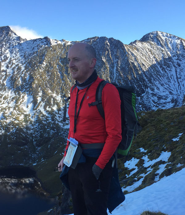
Here you’ll get a taste of what to expect on an Álaind Walking guided tour to Carrauntoohil and some of the routes, more easily accessed from Sneem. This is a report from visits we made during the month of February. As I mentioned before the mild weather in Kerry mostly allows for hillwalking all year round as per these visits. Of course at 1,038m high, there can also be snow which requires winter equipment and experience.
Starting Our Carrauntoohil Challenge in Sneem.
With sunset time for 17:15 and a 6-7 hour hike of Carrauntoohil ahead of us, we depart Álaind lodges in Sneem at 8 a.m. Our guests pre-packed their Gear and lunch and drinks the day before. The journey takes us along route R568, the main Sneem to Killarney Road, known as The Mountain Road.
Not far from Sneem the full magnificent of the Dunkerron Kerry Mountains are in full view. The Dunkerron mountains run down the spine of the Iveragh Peninsula rising from the sea at Caherdaniel to the high mountain peaks at Sneem. The Sneem Mountain Ridge hike is one of our favourite and runs from Coomcallee 650m, Knocknagantee 676m, Finneraragh 667m, Beann 752 and Mullaghanattin (Ireland’s Matterhorn 773m) which marks the limit of the Sneem Dunkerrons.
Beauty of Ballaghbeama Gap
Ballaghbeama gap separates the Sneem Dunkerrons from the eastern Dunkerrons which stretch as far as the upper Lakes of Killarney. Ballaghbeama gap is a beautiful and spectacular place and a hidden gem away on a road less travelled. It’s one of my favourite spots.
It was formed many millions of year ago by glacial breach during the last ice age. As the outflow of the glacier was impeded, the ice got thicker and thicker. Eventually it reached a point where it ultimately breached the mountains at Ballaghbeama gap at 260m elevation to exploit a new escape route.
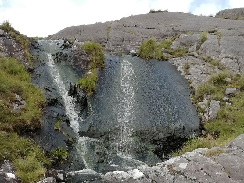
We drive through this gap with its 200m High Cliff walls on a beautiful twisting and winding road. The surrounding mountains are alive with gushing cascades from the previous night’s rainfall. Ballaghbeama Gap, also a favourite of seasoned cyclists, is truly an impressive sight to behold.
Bridia Valley and Beyond.
Onwards we descend into the Valley of the Glashawee River as far as a road intersection near the confluence of the Owenroe and Caragh rivers. Here we’re literally at a crossroads for climbing Carrauntoohil from the westerly side. We can turn left for the Hydro Road car park beyond Glencar or can turn right for the Bridia valley and Black Valley.
Today we turn right into the Bridia valley where the impressive Kerry mountains of Stumpa Duloigh 784m and Broaghnabinnia 745m tower to our right and Curraghmore 822m to our left. Our destinations today are first Caher 1,001m and second Carrauntoohil 1,039m and both are hidden from our view. We find a parking spot beside the Lack road and from here we have a choice of 2 routes to the top of Ireland’s highest mountain Carrauntoohil.
Lack Road Leads The Way.
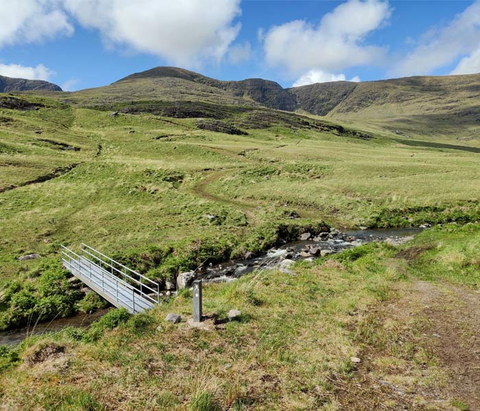
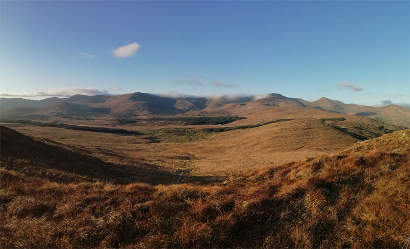
Today’s route begins on the Lack Road which is part of the Kerry way, the longest waymarked trail in Ireland at 214 km. The Lack Road connects the Bridia valley with Lough Accose by cresting the mountain pass into the neighbouring Valley. The Kerry Way’s Lack Road is a grassy path extending through sheep paddocks and open uplands. It winds its way across stiles and babbling Brooks until we reach the crest at 380 m elevation. Looking around at this point southwards provides uninterrupted views of the beauty of the Bridia Valley and the Eastern Dunkerrons.
Curraghmore, Caher, Carrauntoohil.
While the Lack Road continues, here we must leave it to ascend the East north-east spur of Curraghmore 822m, taking care not to continue too far towards the steep slopes surrounding Curraghmore Lake below. From this point the steady pull continues in a Northeast direction to Caher summit. At 1001m Caher is the third highest mountain in Ireland and only 38m lower than Carrauntoohil itself.
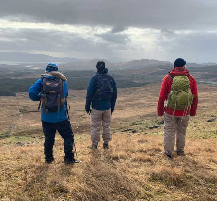
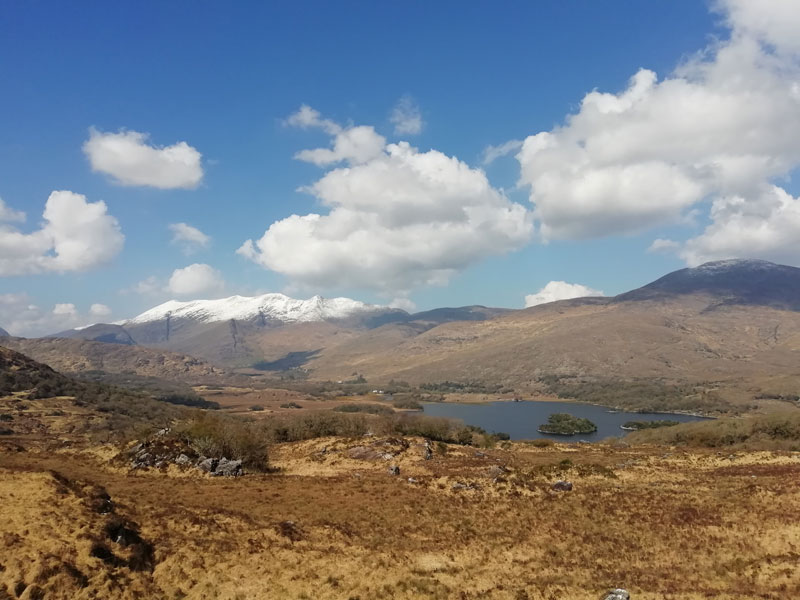
Here we get our first views of the Magnificent Coomloughra Horseshoe and the serrated Beenkeragh ridge or arête. Winds can pick up in strength too and we take care while clambering over the defined but rocky path over a humpback ridge towards the coll at 900 m elevation.
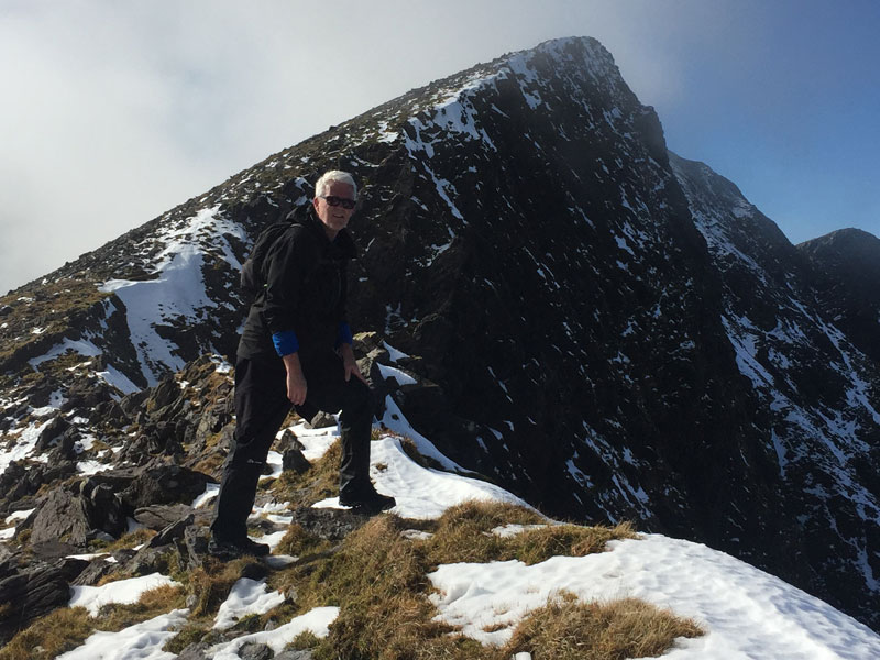
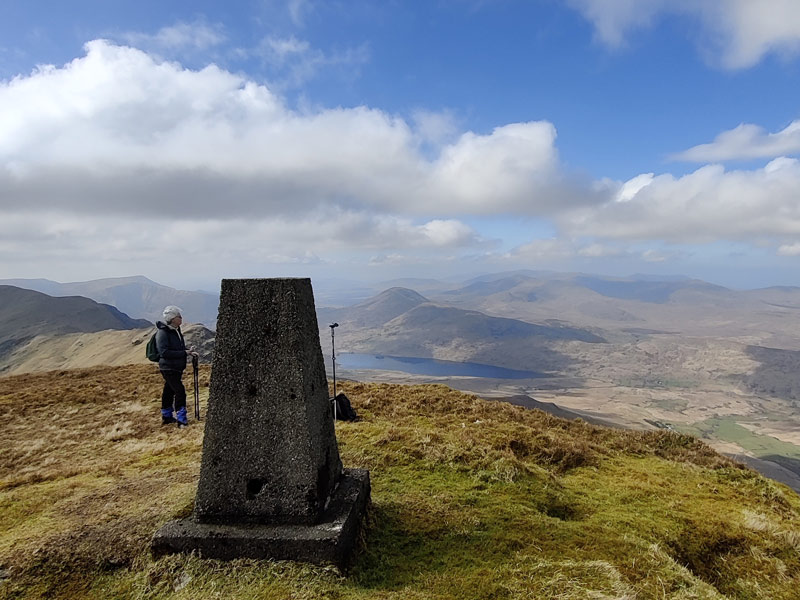
We join a broad but stony slope and begin the North northeast climb to Carrauntoohil Summit. The summit is marked by a stone shelter and metal Cross. We are now standing atop Ireland’s highest mountain at a height of 1039 m. We have walked 7 km and climbed 1060m in height in approximately 3 and a half hours.
Alternative Route: Carrauntoohil via the Hydro Road
Back at the approach road from Ballaghbeama where the rivers meet, we can also turn left and drive to the Hydro Road car park.
The Concrete Road.
The route is known too as the concrete Road and involves an initially steep walk on a 4×4 road with a height gain of 150 m. This can be tough considering we have just set off. It’s typical that Walkers will need to stop and adjust their layers to regulate body temperature.
Indeed climbing Carrauntoohil will involve quite a bit of layer adjustment as our elevation, exposure, cloud cover and weather changes. Mercifully the road levels out after a walk of 600m distance and the incline is more gradual. We have to navigate a gate and here’s a good tip. When climbing over a gate, cross at its hinged and strongest point, as you’ll be less likely to cause damage.
Ascending Caher’s Spur.
We pick our way across wet boggy ground and ascend the Spur to the south of Lough Eighter. For the next 200m height gain, walking is relatively easy across the Broad spur. The Coomloughra horseshoe is visible to us in all its impressiveness with its high peaks and jagged arêtes.
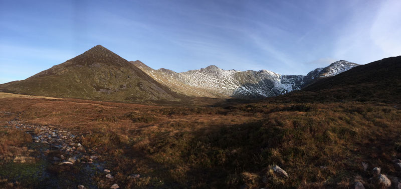
Ahead of us lies Caher summit with Carrauntoohil and Beenkeragh to our left. We’re now looking down on the Valley of the three Lakes, containing Lough Eighter, Coomloughra Lough and Lough Íochtar.
As we continue the climb becomes steeper and stony. Caher’s slopes are scree covered but thankfully we can keep to a well-worn path. We stop just short of Caher West Top (975m) summit to grab a snack and a drink. This is a good place to shelter from the wind that’s awaiting us on top.
Ridge Clambering from Caher West Top.
For the next section we put our walking poles away and begin clambering our way carefully across Caher’s ridges as we take in Caher peak 1001m. For many this will be their first time on a mountain in Ireland above 1000 m and we take a brief moment to take in our achievement.
Continuing to pick our way carefully along the ridge we are now descending again before arriving at the Boulder field on the Broad approach to Carrauntoohil. We have descended again to 900m leaving us 140m climb to the top of Carrauntoohil’s summit.
Savour Your Carrauntoohil Climbing Achievement.
As I said at the start of this post, climbing Carrauntoohil to stand at the highest point in Ireland is a demanding challenge but it’s hugely rewarding. You’ll have the memories of the experience and bragging rights for the rest of your life. Carrauntoohil is a regular feature of Álaind Walking Holiday Tours along with many other fantastic walking experience.
Find out more about our Carrauntoohil Walking Holiday. You’ll stay at our fantastic Álaind Lodges accommodation in a luxury ensuite room, while we’ll bring you each day to amazing places on our walks.
Furthermore as we limit the number of guests on our tours, we assure you of a good time while keeping safe through social distancing.
If you want to make a date for a Carrauntoohil walk, you can contact Fergal Harrington directly by email or by phone at +353-85-1422677.
You can also check out our walking holidays page to see the dates of upcoming scheduled holidays and to view the full range of packages and services we offer.