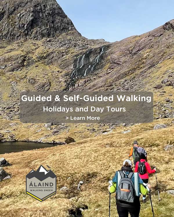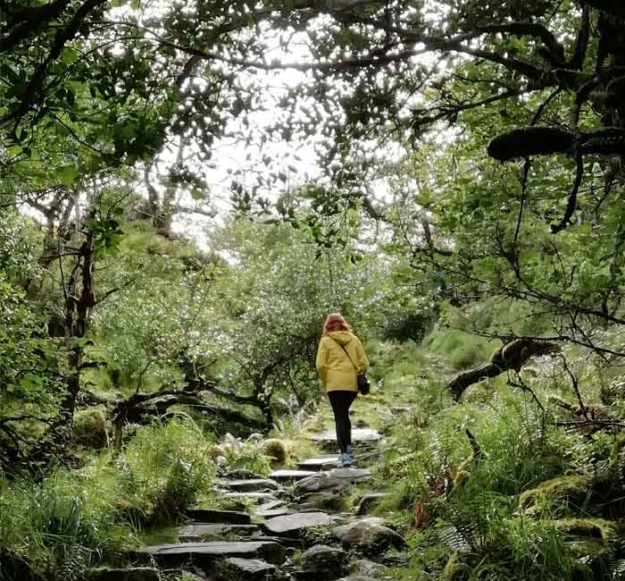


This Sneem walk called the Fermoyle Loop trail gets you quickly and easily into the wild Ring of Kerry countryside and foothills of the Dunkerron Mountains.
The Fermoyle Loop is the longer of the two Sneem Loop Walking Trails (the other being the Lománagh Loop). Way-marked by white markers, the Fermoyle walking trail is 14 km long and takes about 4.5 hrs to complete. Starting and finishing in Sneem village on the Ring of Kerry, it is of moderate difficulty with some long and sometimes steep ascents/descents.
With the terrain rough and uneven underfoot, regular walkers with a good level of fitness find it more suitable. Notwithstanding, it’s worth noting that the highest point on the trail is only approximately 200m, so it’s manageable for most with plenty of breaks.
What to Expect on the Fermoyle Loop?
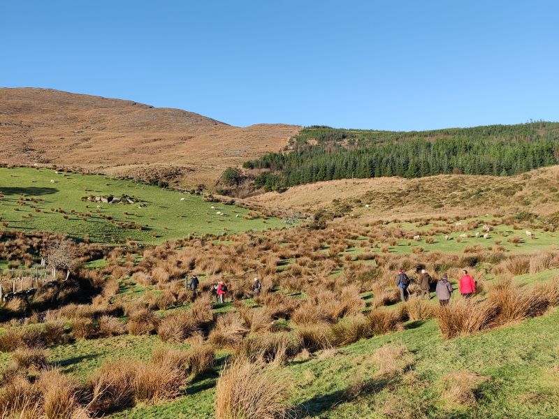
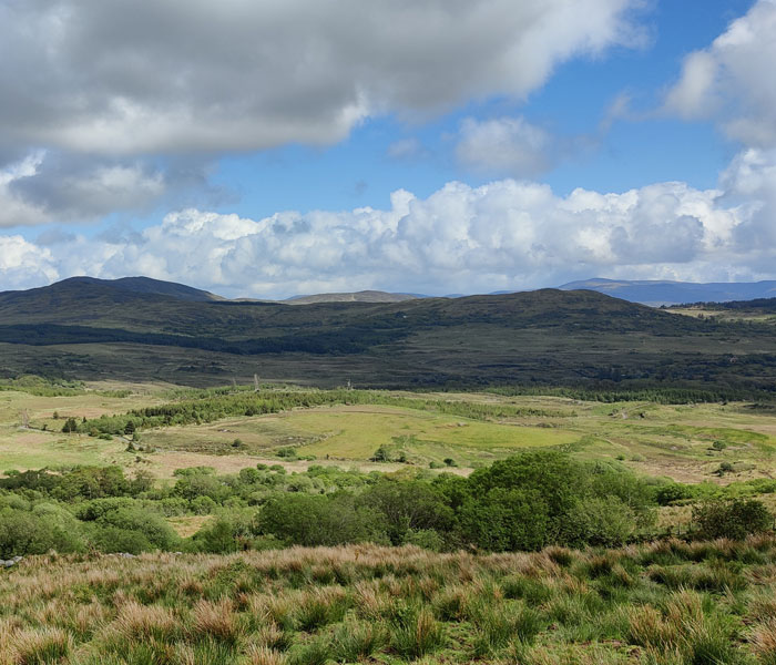
The Fermoyle Loop follows minor quiet roads, farm tracks and way-marked paths across hillside and farmland. It brings you into Sneem’s wild Kerry countryside and up close to the inspiring Dunkerron mountain range. They run east-west down the spine of the Iveragh Pensinsula, which is famously known as the Ring of Kerry. The Sneem peaks of Knocknagantee, Finnerraragh and Beann mountains tower above and we love exploring these with our guests. You can get a taste for the experience in walking and hiking in Sneem.
As the entire mid-section of this Sneem trail crosses privately owned farm land, dogs are not permitted. Please always consider the owners when passing by their houses and please adhere to ‘Leave No Trace’ principles.
What To Wear for Sneem Walks?
- Quick-drying loose or stretchy pants. In fact it’s best to avoid wearing jeans and cotton tee-shirts, which can get uncomfortable when warm and very cold when wet.
- Waterproof trail shoes or walking boots with good grips and good laces.
- Good Walking Socks.
- 100% waterproof shell type jacket.
What to Pack for the Fermoyle Loop?
- Spare warm fleece type top (a couple of thin layers).
- Small backpack for food, spare clothes and other supplies.
- Hat & Gloves.
- Sunscreen.
- Smartphone for contact and for photos.
- Water bottle – preferably a reusable type.
How to Complete this Sneem Walk?
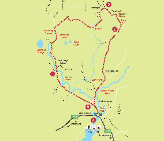
To match the video above, these directions will take you on anti-clockwise route around the Loop. Of course you can do it either way or do it in reverse next time. Approaching from the opposite direction makes the trail feel very different.
Follow These Walking Route Directions
Sneem Village to Sneem Cemetery
From the North Square, Sneem, follow the minor road to the Cemetery, out past the GAA grounds. Look for the signs in the square. After the GAA grounds, the route forks right along a minor tarmac road. 350m along this road you will cross a bridge just before the cemetery. Underneath the bridge runs the Sneem River, well-known in Kerry for its annual run of Salmon and Sea Trout. Indeed the pool here is a popular and often rewarding spot for the members of the local Sneem Angling Club.
Inside the cemetery, you’ll find a large sign detailing the details and locations of the many graves. The fifth and Former President of Ireland, Cearbhall Ó Dálaigh was buried here in March 1978.
Cemetery to Tullakeel
For the next kilometre, continue straight ahead until you reach a fork in the road. Continue left and onward for 2.2km with the impressive Dunkerron Mountains coming into view on your left hand side. Slightly behind and to the right lies the area known as Derreenaclaurig and the 270m tall Knockanamadane Mountain. Translating it from Irish, means the fool’s mountain.
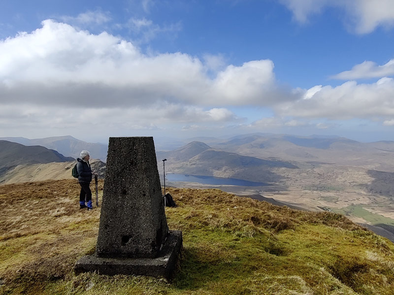
On reaching the 2.2 KM point the white way-marks point to a road to the left which begins to rise quite steeply. You’ll find this area on the map beside the townland name Tullakeel. In fact to reach the high point of this small road, you’ll have to ascend over 100m in height. Take your time here and enjoy the fantastic views down the hill and across the valleys of Gearha and Ardeen.
Between this junction and Tullakeel, the road passes the site of a boulder burial and also rock art. However, being difficult to find, they are in my humble opinion probably not worth the effort to locate them.
Tullakeel to Fermoyle
150m after a very pronounced left road bend, your ascent reaches an end and the Dunkerron Mountains comes into view. You’re now looking down into the heart of an area of internationally recognised geological significance. Characterised by imposing mountains of Old Red Sandstone rocks with many corrie or cooms.
A corrie or Coom describes an armchair-shaped hollow found on the side of a mountain. This is where glaciers formed and you can see their rocky sides and the steep back wall or cliffs. The deposits of the melting glaciers formed the relatively smooth landscape in front of you.
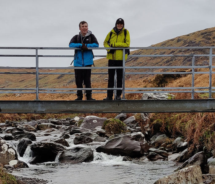
Descending towards the low lying land ahead, you pass the front doors of a small community of families living here. This is Fermoyle itself and whence the walking trail gets its name. Just after the last farmhouse, a short detour to the left along a grassy laneway leads to a Cillín. This is an unconsecrated graveyard) on the site of a medieval Fulachta Fiadh (communal, ceremonial cooking site).
Retracing your steps from this short detour, continue on the laneway down towards the footbridge over the Sneem River. After a night of rain, this pleasant stopping spot transforms to a raging torrent.
The Green Road Across The Hills
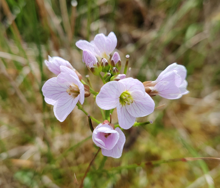
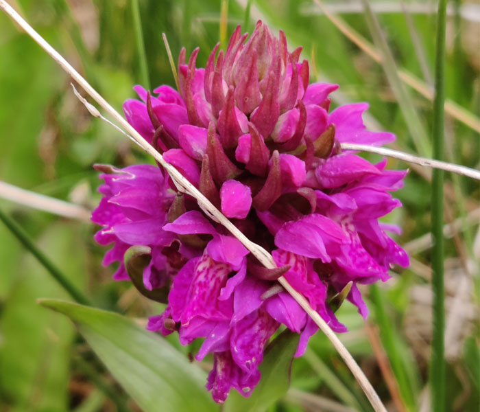
The next section of the walk follows a ‘green road’ upwards and across the hills. You’ll cross a number of smaller streams and styles along the way. Enjoy this section of the walk as it skirts the foot of the Dunkerron Mountains and rocky outcrops. It’s also worth keeping your eyes peeled for wildflowers along the way.
At the other end of this ‘green road’ is a gate to a small farmyard. Please respect the owners here and pass on through without disturbing anything. Take care crossing a particularly tall style and walk for 700m to a road junction, where the markers point left. This is now the road back towards Sneem, which is 5 KM from this point.
Dromtine to Lománagh Bridge
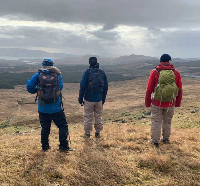
You are now back onto a minor tarred road with very little traffic. Before beginning your march southwards to Sneem, admire the beauty and ruggedness of the surrounding landscape. Keep an eye out for the many animals in the area. These include cattle, deer, mountain goats, Kerry hares, frogs, huge ravens and if you’re really lucky, the white tailed sea eagle. From April to September you will also see a huge array of beautiful Irish wildflowers and much other wonderful flora.
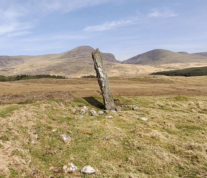
Directly west lies Dromtine Standing Stone, a single stone of 4.4 metres high of late Bronze Age construction. It’s possible it may have served as a territorial marker, ritual site or even for astronomical use. Glacial retreating ice formed the nearby Dromtine Lake, which today is a main water source for the Sneem Community.
From here the road follows largely parallel to the cascading Sneem river and soon you pass the Lománagh Loop turnoff and reach Lománagh Bridge. The bridge lies approx. 3 KM from Sneem and is another favourite spot to linger awhile.
Home Stretch to the GAA Grounds and Sneem Village
Having rested and hopefully feeling refreshed, the final section of the walk awaits. Characterised by woodland and plush roadside verges, it’s nice to test your knowledge and recognition of the plants. Although the river is never far away, it’s often hidden while winding its way through the many pools and bends.
Soon you pass a signpost to Álaind Lodges, which is our base for bed & breakfast, walking holidays and daily guided walks. Feel free to come and visit!
With less than 1 KM to the village, you are passing the fork in the road and the GAA grounds. Hopefully you have time for some apre-walk refreshment in one of the many cafes and bars in Sneem.
If you are interested in exploring Kerry and this wonderful walking area, please read more about us. You can contact me Fergal Harrington directly to inquire about our accommodation, walking holidays and guided walks.