This is a 7km strenuous 4 hour round trip hike to the summit of Mullaghanattin near Ballaghbeama Gap and Sneem on the Ring of Kerry.
Mullaghanattin in the Dunkerron Mountains, at 773m high, offers a tough but rewarding challenge to the regular hillwalker with good fitness. Immediately from the start of this walk, we’re treated to stunning views which only get better the higher we climb.
per Person Price
€60
Tour Duration
4.5 Hours approx
Walk Difficulty
Strenuous: 7 KM with 600m Height gain
Scheduled Dates
Thursday 30 May 2024
Thursday 13 June 2024
Thursday 20 June 2024
Walk Details
We typically meet at 9:45am at MACE, South Square, Sneem or at 10 am at the Ballaghbeama turnoff on R568 Sneem Molls Gap Road. From here we’ll drive to the starting point for the Mullaghanattin Climb. All scheduled walks will proceed once two or more people have booked.
Mullaghanattin (Hill of the Gorse) Mountain Trip Highlights include:
Summiting the 775m high Mullaghanattin Mountain, one of the best mountains to climb in Ireland.
Visiting the verticle walls of Ballaghbeama Gap, where an ice age glacier breached the mountain ridge.
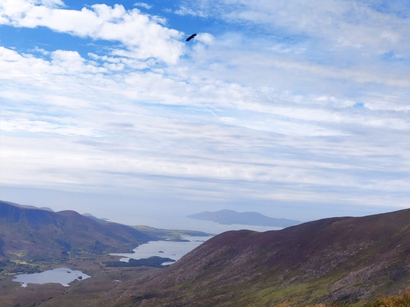
Taking regular breaks to savour the fabulous views across the Ring of Kerry peninsula and beyond.
Marveling at nearby Carrauntoohil in the Magillicuddy’s Reeks and the ‘Pocket’ valley some 600m below.
Exploring this geological wonderland and the incredible heights of the Dunkerron Mountains.
Traversing the open moorland long ago smoothed by the deposits of ice age glaciers.
Possible encounters with sheep, hares, mountain goats, huge ravens and perhaps the white-tailed sea eagles.
Spectacular views of three peninsulas and even more mountain ranges.
Before our hike, we’ll visit Ballaghbeama Gap where the narrow road (200m above sea leavel) cuts through vertical cliff walls. An ice age glacier created Ballghbeama Gap, when it breached the mountain ridge at its weakest point. Today, peering upwards at the 50m high walls is an impressive sight. Here you’ll find a helpful information notice about the Ballaghbeama and the surrounding area including the Magilicuddy’s Reeks and Dunkerron Mountains.
Looking down on Ballaghbeama Gap road
Description of our Route
Today’s guided hike starts near the Gap itself and involves extended periods of sustained ascent to reach the mountain ridge. Consequently, the challenge of Mullaghanattin should not be underestimated and I have rated it as strenuous. This means it is only suitable for those who walk regularly in the mountains and have a good level of fitness.
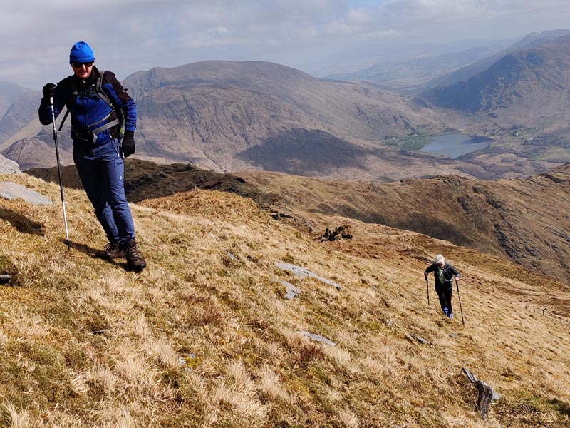
As soon as we start gaining height, beautiful views of Knocklomena and southwards towards Kenmare appear. It’s not long before we’re able to look down on the Ballaghbeama Gap road too. This route doesn’t disappoint for photo oppotunities.
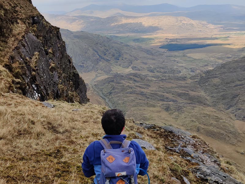
Continuing along this ridge for 1.5 km and high above the valley, we wind in and around the rocky outcrops and great flat sandstone flags. Keeping an eye out for interesting flora and fauna, we might surprise a Kerry hare or two along the way.
Mullaghanattin itself lies to our west and we’ll usually break half-way up one of the tougher sections. When the sun shines and with protection from the prevailing south-westerly winds, we can sit and snack comfortably here. You’ll delight to hear that Mullaghanattin’s summit approach is neither very steep nor very long. It’s south-facing slopes are dry and grass-covered.
The name Mullaghanattin translates from Irish as Hill of the Gorse. Presumably, being bathed in sunshine for much of the day allowed the gorse to flourish. However, sheep and goats have likely since removed most of the gorse.
View towards Lough Brin and Knocklomena
Magnificent Mullaghanattin Views
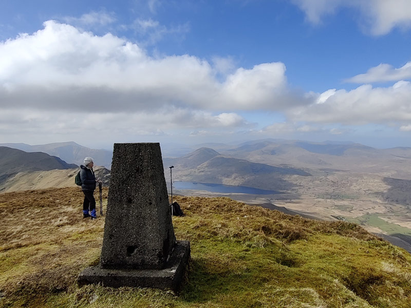
On reaching Mullaghanattin’s top, its 360 degree views do not disappoint. For reason of its unobstructed aspect and prominence, Ordnance Survey sited a triangulation pillar (trig-point) here, probably some time in the early 1900’s. Hence you can see it from many of the surrounding mountain tops.
Mullaghanattin Triangulation Pillar with Cloon Lake and the Caherciveen Horseshoe beyond
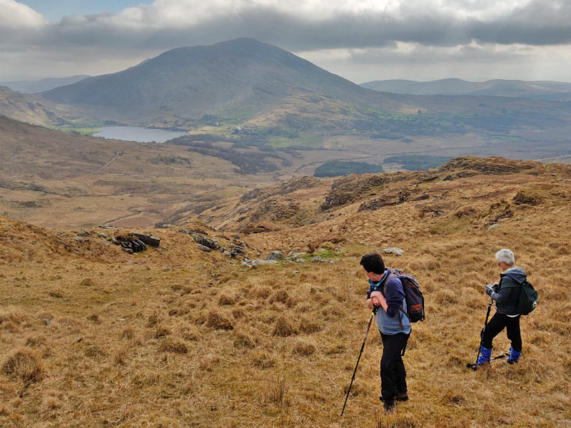
To the northwest you’ll gaze across Cloon Lake and the Caherciveen Horseshoe Mountain and to the north, lie the valleys of Glencar and the Dingle peninsula in the distance. Carrauntoohil & the Magillycuddy’s Reeks loom beyond the Ballaghbeama Gap road to the northeast. The Dunkerron Mountains fan out eastward and westward, which offer more great opportunities for hiking and walking. Spinning around to the south, you’ll see Kenmare Bay, the Caha Mountains on the Beara Peninsula, the village of Sneem and sometimes the Bull Rock and Dursey Island.
While taking it all in, you’ll feel justly proud of your achievement in making it to the top of Mullaghanattin, one of the best mountains to climb in Ireland. If you like how this all sounds, visit our Walks & Hikes – Day Tours page to find the date of the next climb. You can also call me, Fergal Harrington at +353852581480 to organise a hike on your preferred date.
Afterwards, why not visit nearby Sneem for refreshment or a bite to eat in one of the many fine pubs and restaurants. If you’re thinking of staying in the area and looking for a room, I think you’ll find Álaind Lodges, my bed & breakfast, the perfect choice.
Scheduled walking experiences will proceed once two people have booked. Private experiences are subject to minimum number of 3 or the equivalent in charges.
Full refund: In case of cancellation due to inclement weather (e.g., heavy rain, strong winds, thunderstorms). You’ll have the option to reschedule for another date.
"We fancied doing something different for our long weekend and booked to walk the Kerry Way. We got such a buzz from walking the hills around Sneem. What a refreshing experience from start to finish. It was a great decision, we had an amazing time"