This Kerry Walk called the Lomanagh Loop is a family friendly walking trail in Sneem and takes around 3 hours.
The Lomanagh 3.5 hr Loop Walk in Sneem is a mix of tarred road, gravel track and hillside meadow. It, along with the 4.5 hr Fermoyle Loop are the village’s two main signposted local trails. Due to its low lying nature (total ascent of 200m) this Kerry Walk is a very scenic adventure that everyone can do. It’s an ideal family walk.
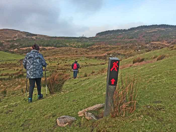
Organising a group activity can often be a challenge. It’s for this reason you should definitely make the Lomanagh Walk part of your things to do in Sneem. Because this delightful Ring of Kerry Loop Walk both starts and finishes in the beautiful village, it’s perfect for a group activity. Coming in at around 3 – 3.5 hrs, it’s just the right length too and its 10km can be completed easily.
The Lomanagh loop can be completed clockwise or anti-clockwise. Whichever orientation you opt for, rest assured it will be a manageable walk for the entire group.
How Challenging is this Kerry Walk?
Here are the key facts for this Kerry Walk:
- Distance 10k.
- Duration 3-3.5 hrs.
- Maximum height 179 metres.
- Total height gain 200 metres.
- Ordnance Survey Map No. 84 details the topography of the route
- Mostly easy road or path with a moderate hill in the middle.
- Trail surface is a mixture of tarred road, gravel track and boggy meadow.
- No dogs allowed.
It’s safe to say most people find the walk relatively easy going. For even when you come to the short steep bits, a slow and steady approach will see you through.
One of the many reasons I like this walk is that you can grab a tea or coffee in a cafe or pub in Sneem while waiting for the group to arrive and get their gear ready. Not that you’ll need specialist gear for this walk, of course – waterproof boots and a waterproof jacket should suffice.
Depending on the weather forecast I recommend a small rucksack with the extra bits the group my need. Examples of these might include snacks, sunscreen, some light warm tops, hat, gloves etc. and adequate water.
You don’t need a map for this Kerry Walk, as the Lomanagh Loop is way-marked in its entirety. However, if you are familiar with Ordnance Survey Maps, I recommend OSI Map number 84, which will help you identify features and locations you see in the distance. Happily, Una in Sneem Bookshop in the South Square of the village usually has a good stock of maps. The one that you want is Ordnance Survey Map Number 84 – scale 1:50,000.
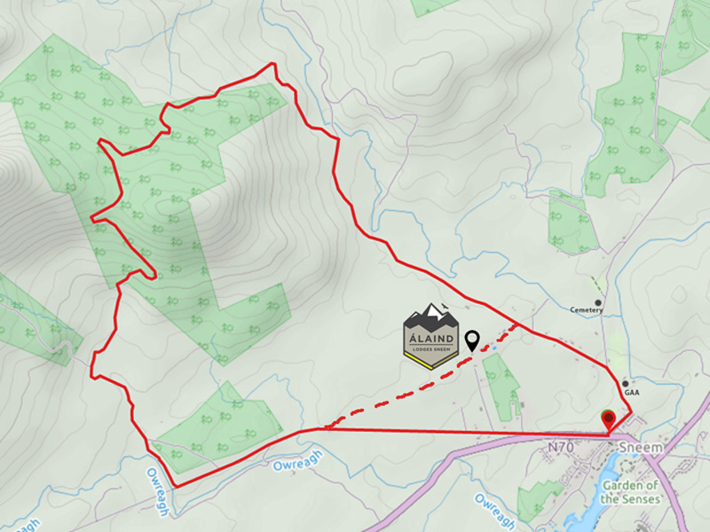
You have two options for completing today’s walk, namely clockwise from the Waterville Road or anticlockwise from the Sportsfield Road. The former tackles the main hill via a short sharp walk while the latter involves a longer more gradually inclined walk.
Guide to completing the Lomanagh Loop Kerry Walk
In this post I’ll describe the route from an anti-clockwise perspective, meaning that you’ll begin on the Sportsfield Road in Sneem. For easy of navigation, this trail follows red trail markers on the side of the road. (If doing it clockwise, you start on the Kerry Way in the Direction of Caherdaniel.) The white markers that you’ll encounter direct walkers around the Fermoyle Loop.
Starting out on the Sportsfield road, you follow it past Sneem GAA club and left at the fork for 2.5km. Along the way, the road passes two brown signs for Álaind Lodges (where Álaind Walking is based), as you venture deeper into Kerry GeoPark.
Welcome to Kerry Geopark – A Remarkably Scenic Location
Kerry Geopark comprises the areas around Sneem, bordered by Kenmare Bay to the south and Dunkerron Mountains to the north. Interestingly, experts recognise it as one of the most significant geological areas in Europe. Indeed the old red sandstone mountains, glaciated features, ancient archaeological sites, Irish Language, history and culture all combine to enhance the attractiveness of this remarkable region.
Quiet Tarred Road Section Through Kerry Geopark
The tarred road continues northwards into the GeoPark whereupon it’s possible to see the Sneem river running parallel. At this point, you’ll be very much immersed in wild countryside and the the tranquil sounds of nature.

Having walked for 2.5km, the red Lomanagh trail markers now indicate a left turn up an inclining lane to a farm gate. You are now entering onto private land and happily with the landowner’s permission. It’s important to recognise that past this point is a working farm and that dogs are prohibited .
The Forest Track to Lomanagh Hill
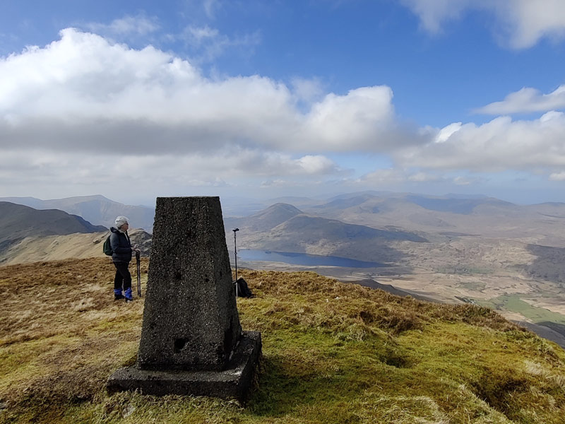
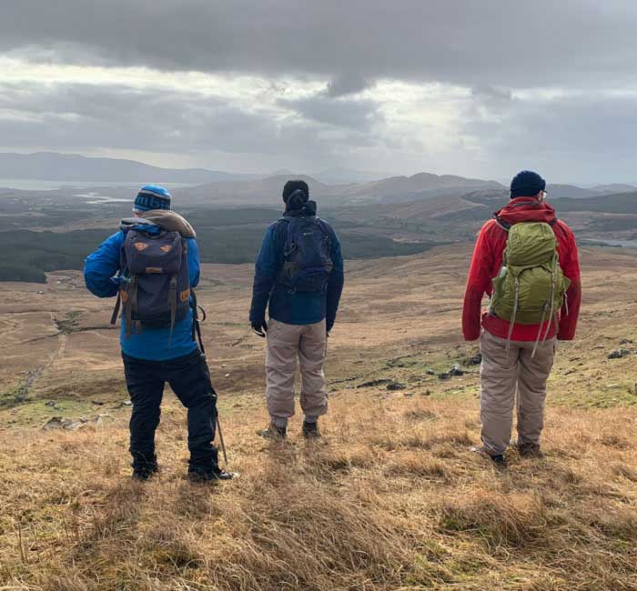
You are now at the beginning of the forest track and another gate awaits. Looking closely at it, you see the different organisaions involved in the development of Kerry Walks. Now is a good opportunity to stop and admire the spectacular vista of The GeoPark and Dromtine Reservoir lake. Furthermore, with binoculars you’ll see one of the tallest standings stones on a raised grassy circular fort north of the lake.
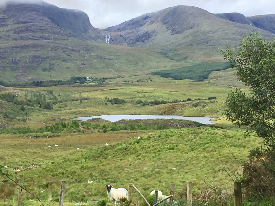
The forest track will climb 100m as it winds itself for the next 1.5km to the top of Lomanagh hill. On one of my recent visits, I saw deer there but they are still few in number and very shy.
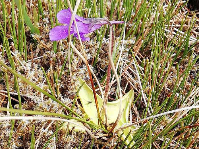
If you’re visiting in summer, keep an eye out for the purple butterwort carnivorous flower. Don’t worry, the flowers consume small flies mostly, which stick to its green shoots and get dissolved. They provide the plant with valuable nutrients, which otherwise are missing from the poor boggy soil.
Follow the markers to the hilltop for a break for a snack and a hot drink from a flask. The views across Sneem and Kenmare Bay to the Beara Peninsula are impressive provided the young trees are cut back.
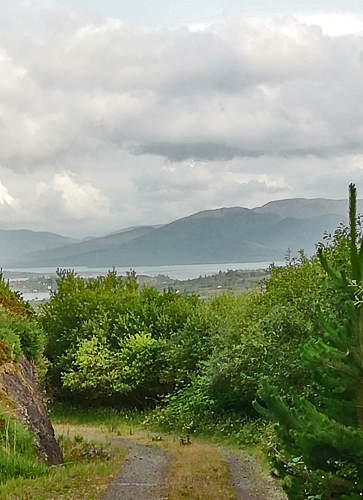
Its worth making that trip to the the Beara Peninsula, which is mere 10km by boat from but a full hour by car. You’ll have to leave that experience for another day however, but it’s definitely another of the wonderful things to do in Sneem.
Crossing The Grassy Meadows of Lomanagh
One of my favourite parts of the Lomanagh loop walk lies just ahead. First of all, you must continue down the hill while following the forest track to its end. When you reach the path’s end, trust the markers. They steer you through a narrow grassy track and overgrowth until you exit the forest.
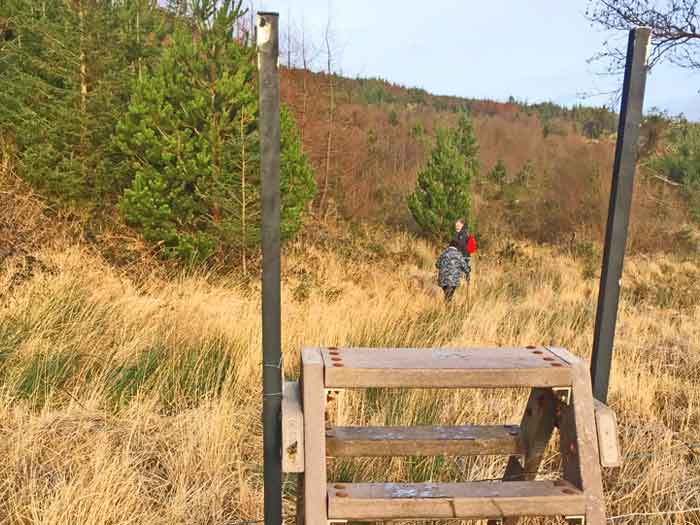
Here begins my favourite section of this delightful Kerry walk, which I like telling people about. It can, however, be boggy which is the reason I suggested wearing waterproof boots. While wearing a good pair of boots, you can confidently splish splash your way through all the meadow’s puddles.
Although you may not have concerned yourself too much with the markers up to this point, they must be carefully followed from here. Don’t be enticed to pass through any gates or fences unless a marker directs you. Trust me it’s easily done, so simply look ahead for the next marker and move towards it.
These grassy meadows appear well-manicured but in reality it’s thanks to the sheep and their love of grass. Writing this now reminds me what a lovely place it is that they call home. Be sure to languor here as you listen to the sheep and the running water in the small streams.
Owreagh River and Native Woodland Walk
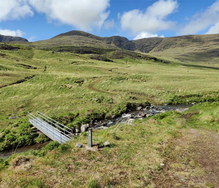
Fantastically, just ahead there’s an idyllic little river ford at the bottom of the meadow. Again, depending on your boots, you can cross the bridge or run right through the shallow water!
Once across the ford, turn left onto a track that gradually descends for 1km to join the Kerry Way. If you’re lucky, you might meet some Kerry lamas in a paddock along the way. Try challenging them to a staring contest, although I know on whom I’d put my money!
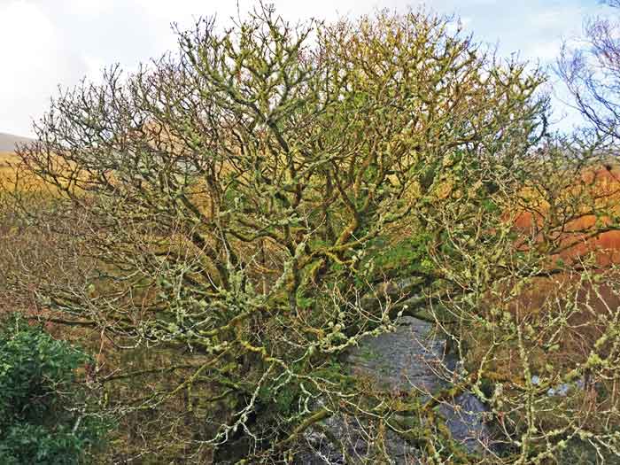
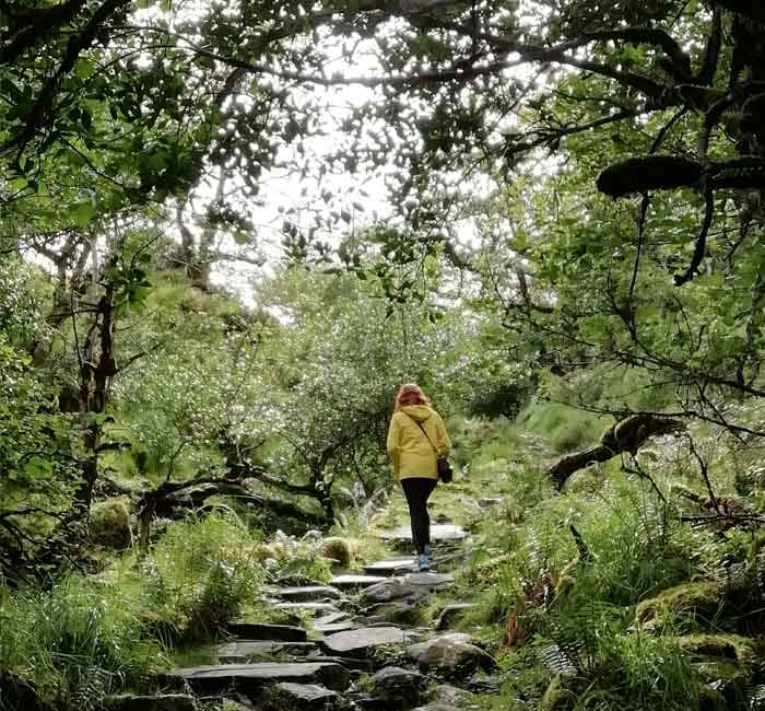
This gravel track picks up the course of the Owreagh River which passes through a beautiful area of native woodland. Due to the calming and relaxing feeling you get when among native woodland trees, it’s always a pleasure to spend time here.
Meeting the Kerry Way Walking Route
Finally you reach the tarred road of the Kerry Way, which means you’ve completed about 7km so far. The Loop’s Red markers point to the left in the direction of Sneem, whereas the yellow markers belong to the Kerry Way route from Sneem to Caherdaniel.
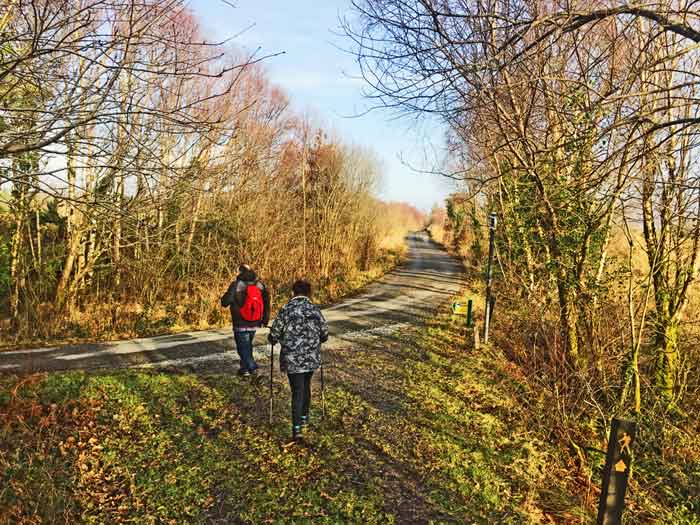
Before you hightail it back to Sneem, take a little detour here of 100m or so to the right. It’s worth doing to find the little metal bridge standing 4-5 meters above the Owreagh River, which makes for great photos.
Having enjoyed this detour, turnaround and follow the boreen and the red (and yellow Kerry Way) markers for 3km. Finally this will bring you back to Sneem and your car.
What nicer way to finish the day’s activity than remaining in Sneem for a bite to eat and drink? There few things more enjoyable than discussing the highlights of a Kerry Walk experience over a tasty meal.
Planning Your Next Kerry Walking Activity
Now that you’ve discovered the magic of Sneem, you might want more ideas for walks and things to do. I delight in hearing how people enjoyed their Kerry Walk experience, so comments are always welcome.
Most importantly, if you enjoy this wonderful and easily accessible Kerry Walk, don’t forget to tell your friends. It’s worth baring in mind, for the next time, that doing Lomanagh clockwise is equally exhilarating.
In conclusion and in my humble opinion, the Lomanagh Loop is one of the best Loop Walks on The Ring of Kerry. For me, it’s attractions are convenience, accessibility, varied scenery, distance and suitability for pretty much everyone. Finally, if you are looking for another challenge, you should check out Sneem’s other loop trail – The Fermoyle Loop.
Lomanagh Loop Guide brought to you by Álaind Walking Sneem – Discover Amazing Places
